Introduction
Geodesy is a branch of science concerned with accurate measurement of
Earth in space and time. It is useful for all sorts of things, ranging from satellite navigation systems (think sat nav in your car) to answering geophysical questions such as movement of tectonic plates, and measuring environmental processes like sea level rise.
Modern geodetic techniques have become sophisticated enough to require accurate, frequent determination of Earth Orientation Parameters - parameters describing the orientation of Earth in space, such as the rate of rotation and tilt of the rotation axis. A number of space geodetic techniques exist for this purpose. These include Global Positioning System (GPS), Satellite Laser Ranging (SLR), Lunar Laser Ranging (LLR), Doppler Orbitography (DORIS) and Very Large Baseline Interferometry (VLBI). Each have their own advantages and drawbacks.
VLBI is a technique that utilizes observations of distant reference point sources from many widely spaced telescopes around the world to construct a virtual high-resolution telescope. By observing objects that are effectively fixed on the sky, VLBI is unique amongst space geodetic techniques in providing a quasi-inertial reference frame. In other words, VLBI can position the Earth in space. Satellite-based techniques, on the other hand, can only measure positions relative to their orbit around the Earth. Because of this, VLBI is the only technique capable of measuring the Earth's orientation parameters accurately and simultaneously.
Geodetic VLBI can be used to do all sorts of exciting environmental
science. In fact, the theory of plate tectonics was verified by VLBI
as part of NASA's Crustal Dynamics Project. Improvements in geodetic techniques mean we can now measure not only plate movement, but also intraplate strain and hydrological signals such as underground water and sea level rise. There is also an unexpected bonus - studying the structure of AGN used for geodesy can help constrain some important parameters (such as jet power) relating to feedback from these objects in galaxy formation.
Modern geodetic VLBI techniques can measure distances of thousands of
kilometres to sub-centimetre precision. Incredibly, this means that one of the fundamental assumptions of classical
VLBI - that the quasars we observe are perfect point sources - becomes
a problem.
Quasar
structure and evolution
An ideal VLBI reference source is a bright point on the sky. Distant quasars, which are simply Active Galactic Nuclei at high redshift, are perfect for this purpose. We see these objects as bright point sources because they are far away and have powerful jets that are directed almost directly at us.
In geodetic VLBI, positions on Earth are estimated from arrival times
of pulses from quasars located at known positions in the sky. If the
quasar jets have even a small component in the plane of the sky, the
effective position of the quasar as seen by the radio telescope
shifts, compromising geodetic accuracy. Measured quasar positions also
depend on observing frequency due to self-absorption effects. Finally,
quasars are dynamic objects which often exhibit variability on timescales ranging from days to years. Knowledge of AGN physics is required to correct for all these effects.
I work on quantifying and mitigating the impact of quasar "defects" on
geodetic solutions. To do this, I use a combination of
state-of-the-art geodetic software, and multi-frequency data collected
by UTAS and other radio observatories.
Twinkle, twinkle humongous jet
A lot of quasars used for geodesy are not well-suited for the
purpose. I have been developing methods for selecting AGN which are suitable for geodesy. It turns out scintillation (twinkling) properties of quasars are a useful proxy for how compact (i.e. how close to a point source) an AGN is. The faster the brightness of the quasar changes with time, the smaller it is. That's why stars twinkle and planets don't - they are simply too close!
By combining multi-wavelength radio data with geodetic analysis, I am
developing methods for selecting "good" quasars that can be used in
future high-precision geodetic campaigns. Conversely, I am also
developing techniques that enable the use of geodetic data for
studying quasar physics.
Observing strategy
Uniform (or as close to uniform as possible) coverage of the sky is
desirable for geodetic VLBI. Earth's orientation, however, means that
some quasars are only observable from certain locations on the
planet. At the start of 2010, only three geodetic VLBI telescopes
routinely operated in the southern hemisphere, and the bulk of
southern quasars is correspondingly not well studied. As part of the
AuScope program, the University of Tasmania has begun to rectify
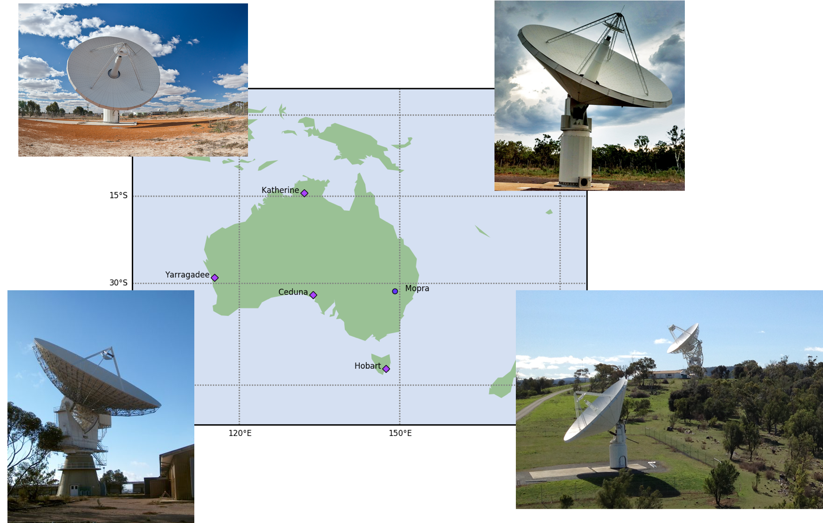
this. Three new 12 metre dishes have been installed at Cambridge
(Tasmania); Yarragadee (Western Australia) and Katherine (Northern
Territory).

The University of
Tasmania is the only university in the world to operate a
continent-wide array of radio telescopes.
Having more telescopes increases the number of observations that can
be made in a given 24-hour session, and therefore improves geodetic
accuracy. However, how we look at quasars (i.e. with which
telescopes and at what time) turns out to be important - exactly the
same quasar jet can appear to have less or more projected structure depending on
time of day and observing configuration. Together with colleagues in Tasmania and
Austria we have performed the first simulations
of these effects, and are now testing these predictions with dedicated
observations.

